There is no doubt that the popularity of drones has grown significantly over the last few years. As they become easier to fly and become less expensive they are finding their way into the hands of many landscape photographers. They open up a whole new set of creative possibilities. In this article, I will show you 5 landscape shots that you can only get when using a drone.
When you take a look at the book The Earth from the Air by Yann Arthus-Bertrand you will likely marvel at the awesome imagery contained within. This book is truly a piece of art. However, many of Yann’s photographs were either shot from hot air balloons or helicopters. So unless you are particularly rich or have rich friends, photographing from a helicopter isn’t going to be that practical.
Drone Photography
With the arrival of drones on the market all that has changed. No longer do you all your landscape images need to be taken on the ground. Even a drone at 100 ft can open up your compositions to a whole new set of creative ideas.
But isn’t drone photography a fad I hear you cry out? Definitely not. Major competitions such as Outdoor Photographer of the Year now have a dedicated View from Above category and several drone images were placed in Landscape Photographer of the Year last year. Photographers like David Hopley now dedicate much of their portfolio work to images taken with drones.
With manufacturers like DJI making drone photography easier, more accessible, and less expensive, there has never been a better time to do something a little different with your landscape photography.
So, what makes landscape photography with a drone so popular and interesting? Let me show you 5 landscape images you can only get with a drone. (OK, I’ll qualify that. You will be able to get these shots with something like a helicopter or a hot air balloon, but I’m going to assume that’s not a practical option for you.)
1 – The Elevated Landscape
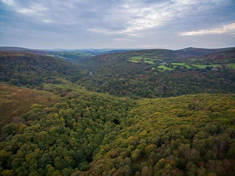
Probably one of the most straightforward landscape shots you can take with your drone is the elevated landscape. In many ways, it is no different from a typical landscape image that you might take. The big difference is that you will be taking the image from an elevated viewpoint.
Taking your drone as high as it, or the law will allow, isn’t necessarily required. Even a height difference of just 50 or 100 feet can make all the difference to the way your image looks. The way you approach the composition of your image will be very much the same though. You’ll likely want to follow the rule of thirds and have a strong foreground and background.
2 – The Big Panorama
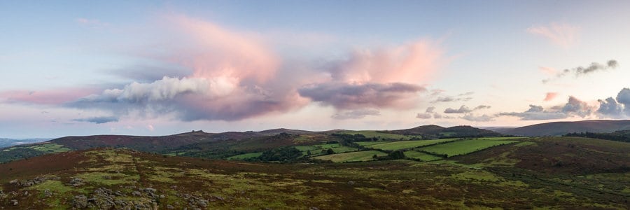
When you want to take your elevated landscapes to the next level you can try and take a panorama with your drone. If you follow the same approach as you do on the ground you’ll find it relatively easy to do this. Many drones (like the DJI Mavic Pro that I fly), allow you to put the camera in a vertical orientation allow you to capture more of the scene as you pan the camera.
3 – Patterns and Shapes
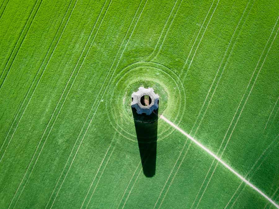
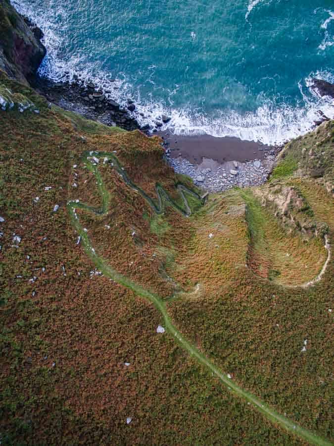
One of the wonderful things about flying a drone is that it opens your eyes to the natural or manmade patterns and shapes of the landscape. Unless you are on a hilltop it can be hard to spot them. However, the drone has one big advantage over the hilltop viewpoint. With a drone, you can point the camera straight down.
With the camera pointing down all those lines and shapes can take on a graphical form producing strong compositional elements. The lines left by a tractor as it drives through a field of crops are often used as leading lines for landscape images, but by viewing them from above they take on a whole new form as they turn into patterns and shapes.
4 – Out to Sea
Unless your name is Icarus you probably won’t be flying out over the sea to take photographs anytime soon. Your drone, on the other hand, is perfectly designed to fly out and take an image of the coast. Illuminated cliff faces at sunrise or sunset can look spectacular or you can show all 3 sides of a peninsula.
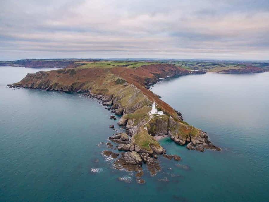
I will add one additional word of warning when flying your drone out to sea is that the wind will typically be a little stronger so be sure you have enough speed (and battery) to get it back.
5 – Roads, Paths and Rivers
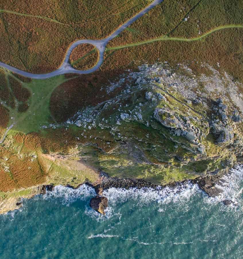
You may not notice from ground level but all those roads, paths and rivers make some interesting lines on the landscape. From the elevated position a drone gives you, even dull looking roads and paths can suddenly turn into one your key elements in a composition.
Making the Impossible Possible
Hopefully, I’ve shown you how a drone can open up your landscape photography up to a whole new world. I’m not suggesting we all get rid of our DSLRs or mirrorless cameras, but by having a drone as part of your kit bag (even some of the time) will allow you to get shots that were once impossible or very expensive for the landscape photographer to get.
There’s certainly never been a better time to get into landscape photography with a drone!
Some Quick Planning Advice
OK, this should really go without saying, but if you are planning on using your drone for photography (or video for that matter), please make yourself familiar with the regulations in your country. Be sure to check for any local regulations that might be in place as well. Lastly, check the weather see if it is practical to fly your drone.
I find the following apps very useful:
- Drone Assist (UK Only) – Provides information on areas where it is prohibitive or dangerous to fly your drone.
- UAV Forecast – Weather app with useful information on wind speed at typical flying altitudes.
Read more on the Improve Photography Network
If you’d like to know more about drone photography in general then check out these other great articles on the Improve Photography network.
- 10 Sure-Fire Drone Photography Composition Tips
- 12 Tips for Flying with a Drone
- Photo Taco – Jumping into Drones
So do you own a drone? Do you use it seriously or just for fun when it comes to photography? Do you think drone photography is a fad or boring? Let me know in the comments below.

I love my drones and they are a great way to get some outstanding shots . But be careful what you shoot , I had two videos of the Dam at Sam Rayburn Lake and the Corp Of Engineers called me and asked me to take it down for security reasons . They were nice but said the dam was a “no fly zone” . It’s not on the No Fly Zone map site and there were no signs posted there . So you need to be careful where you shoot drone videos and pix .
Spencer Boaz .
Hey Spencer, thanks for reading and leaving a comment. That’s an odd but not unsurprising story about the dam. Most of the time there are hundreds of images available for these installations, not to mention satellite images from Google Maps. It makes no sense to say your video is a security risk. Saying that, sometimes it’s just not worth the hassle.
In the UK, NATS (National Air Traffic Services), has a really good app that notifies you of not only no fly zones, but areas where flying your drone might cause you unwanted attention, such as a nature reserve. It’s very useful.
Thanks again for reading.
Hi Julian
I’ve just seen a referral from your article here to my website. Thank you for the mention.
Regards
Dave
Hey David,
No worries. I heard your interview on The Togcast and remembered your images from LPOTY. Great work. Thanks for checking this article out.
Cheers
Julian
I’d love to see a new landscape photo list for 2018 considering how drones are becoming more popular. These landscape photos are nice but I bet we could do a lot better now. Thanks for sharing!